 CERESChemical Emergency Response E-Service
Capability sheet
Every model CERES runs, and where it comes from.
CERES runs the US EPA and NOAA ALOHA algorithms natively and adds the fire, explosion, radiological and terrain models a hazmat team or a plant needs. Each one is documented with its published basis, takes the same weather and site data, and draws on the same map with the same levels of concern.
- ALOHA 5.4 source terms and dispersion, checked run for run against ALOHA output
- Twenty-one further models, each documented with its basis, from Baker-Strehlow-Tang and Kingery-Bulmash to INERIS, Glasstone-Dolan, HotSpot and SCICHEM
- One output vocabulary: zones, time cone, wind-confidence lines, threat at a point, population
Dispersion
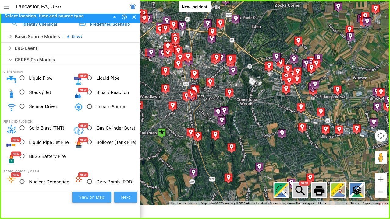
Source term and cloud in one run. The free sources cover the everyday release; Pro models cover what ALOHA cannot represent.
| Model | What it answers | Basis | Tier |
|---|---|---|---|
| Gaussian dispersion | Downwind concentration of a neutrally buoyant gas or vapor cloud, indoors and outdoors. | ALOHA, US EPA and NOAA | FREE |
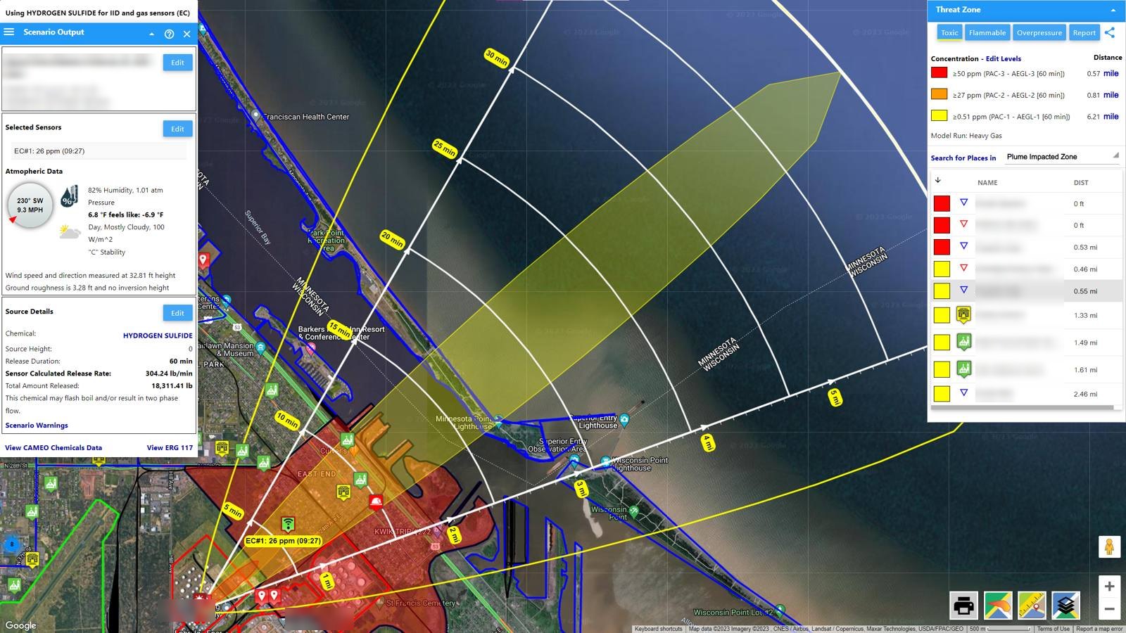
| Heavy-gas dispersion | Dense clouds that hug the ground and spread crosswind: chlorine, ammonia, LPG, refrigerated liquids. | ALOHA, DEGADIS-based | FREE |
| Direct source | An instantaneous or continuous release of a known amount, by mass or volume, at any height. | ALOHA | FREE |
| Puddle | An evaporating or boiling pool on land or water, from spilled or spreading liquid. | ALOHA | FREE |
| Tank | Liquid, gas or two-phase release from a vessel through a hole or valve, with the RAILCAR 4 mist-pool source term for pressurized liquids from tank cars. | ALOHA; RAILCAR 4, DHS Jack Rabbit tests | FREE |
| Gas pipe | Release from a ruptured gas pipeline, connected or isolated. | ALOHA | FREE |
| Liquid flow | A continuous liquid spill feeding an evaporating pool, release rate and pool growth computed together. | CERES, ALOHA puddle physics | PRO |
| Liquid pipe | A breached liquid pipeline: drain-down, flashing vapor and the cloud from what reaches the ground. | CERES | PRO |
| Stack and jet | Elevated stack or pressurized jet releases, with the ignited jet-fire case. | CERES | PRO |
| Elevated heavy gas | Dense vapor released at height: descent, touchdown distance and the ground-hugging cloud after it lands. | CERES | PRO |
| Binary reaction | Two chemicals mix and generate a toxic gas: the product, its release rate and its plume. | CERES, CAMEO reactivity | PRO |
| Water-reactive spills | Titanium tetrachloride, phosphorus trichloride, oleum: the acid-gas cloud from the reaction, not only evaporation. | CERES | PRO |
| Smoke, soot, deposition | Fire smoke as a modeled hazard: PM2.5 plume, SO2 and ground deposition footprints. | CERES | PRO |
| Petroleum and crude | Benchmark crudes and refined fuels with assay-grounded properties for pool-fire and smoke modeling. | CERES, published assays | PRO |
| Oil spill on water | Drift and spreading of a spill on a river, harbor or coast, with boom sites and gauges where available. | CERES | PRO |
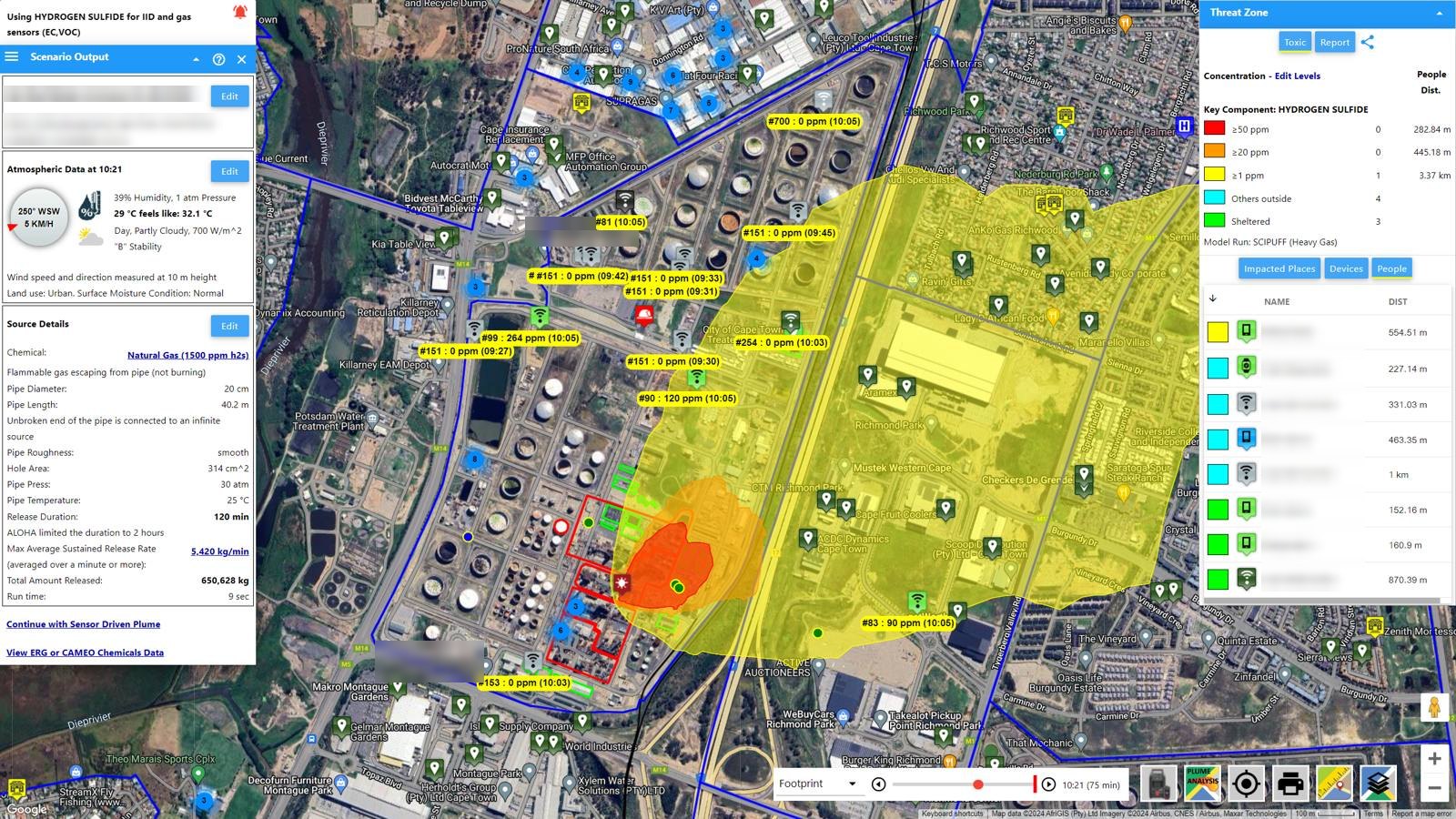
| Sensor-driven plume | Live detector readings set the release rate; the footprint refreshes as the detectors report. | CERES | HAZMAT TEAM |
| Locate source | Works back from the concentration pattern across the detectors toward the most likely origin. | CERES | HAZMAT TEAM |
| SCICHEM | Time-varying three-dimensional puff dispersion over hills and valleys with forecast weather, vertical profiles included. | SCICHEM, EPRI | LIVE FACILITY |
Fire and thermal radiation
| Model | What it answers | Basis | Tier |
|---|---|---|---|
| Pool fire | Thermal radiation zones around a burning pool. | ALOHA | FREE |
| Jet fire | Flame length and radiation zones from an ignited pressurized release. | ALOHA | FREE |
| BLEVE fireball | Fireball diameter, duration and thermal dose zones from a tank failing in fire. | ALOHA | FREE |
| Flash fire | The flammable area of a drifting cloud at fractions of the lower flammability limit. | ALOHA | FREE |
| Pool-fire radiation | Thermal zones with validated flame geometry and smoke obscuration for large pools. | POOLFIRE6-class | PRO |
| Liquid-pipe jet fire | Jet-flame geometry and radiation zones from an ignited liquid pipeline release. | CERES | PRO |
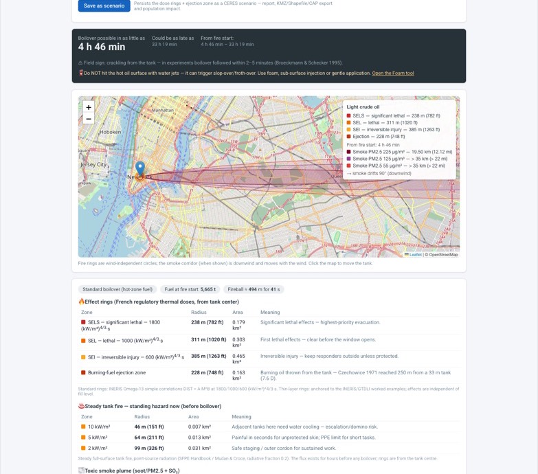
| Boilover | Time to boilover of a crude or fuel-oil tank fire, French regulatory thermal-dose rings and the burning-fuel ejection zone, plus the smoke plume. | INERIS Omega-13 | PRO |
| BESS battery fire | Radiant heat-flux rings from a grid-scale lithium-ion fire scaled from the stored energy, the toxic HF plume and the vent-gas explosion case. | CERES, published BESS tests | PRO |
Explosion
| Model | What it answers | Basis | Tier |
|---|---|---|---|
| Vapor cloud explosion | Overpressure zones when a flammable cloud ignites. | ALOHA | FREE |
| Vapor cloud explosion, congested | Overpressure rings at 8, 3.5 and 1 psi for a cloud igniting over congestion, standalone or from a live dispersion run. | Baker-Strehlow-Tang | PRO |
| Solid blast | Overpressure rings from a solid explosive charge or a TNT-equivalent mass. | Kingery-Bulmash | PRO |
| Gas cylinder burst | Blast rings from the catastrophic rupture of a pressurized cylinder, with the fragment hazard note. | CERES, DDESB fragment data | PRO |
Radiological and nuclear
| Model | What it answers | Basis | Tier |
|---|---|---|---|
| Nuclear detonation | Blast, thermal, radiation and flash zones by yield and height of burst, with the downwind fallout footprint. | Glasstone-Dolan; WSEG-10 fallout | PRO |
| Dirty bomb | Blast zone and the downwind dose and contamination plume of a radiological dispersal device. | HotSpot method | PRO |
Emergency Response Guidebook events
The full ERG 2024, oriented to the live wind and drawn on the map with the receptors inside the distance.
| Event | What it draws | Basis | Tier |
|---|---|---|---|
| Hazmat | Initial isolation and protective-action distances by material, container, day or night and fire, from Tables 1 and 3, with the guide page and the CAMEO data. | ERG 2024 | FREE |
| IED | Evacuation distances by device, from the pipe bomb to the semi-trailer. | ERG 2024, DHS-ATF | FREE |
| BLEVE | Evacuation distances for LPG containers in fire by tank size. | ERG 2024 | FREE |
| Chemical-warfare agents | Isolation and protective-action distances for the agent classes. | ERG 2024 | FREE |
| Pipeline | Evacuation distances for natural-gas pipeline events by pressure and diameter. | Pipeline ERG | FREE |
What every run draws, and what it needs
- Threat zones
- Up to four levels of concern from AEGL, ERPG, PAC, TEEL or IDLH, fractions of the LEL, thermal flux in kW/m² or overpressure in psi, or your own values; on the map, in the report and in the KMZ.
- Time
- Snapshot and footprint views on a time slider in five-minute steps; the downwind time cone from the wind speed; scenario history for every run.
- Wind uncertainty
- Wind-confidence lines from the stability class, so the zone shows where it moves if the wind backs or veers; a 360-degree vulnerability zone for the planning case.
- Threat at a point
- Indoor and outdoor concentration and dose over the first hour at any point, by building type, so shelter-in-place against evacuation is a number.
- People and places
- Census population inside each zone; impacted places, zones and neighborhoods identified automatically and sorted by distance; infiltration analysis for many receptors in one report.
- Detectors
- Sensor placement study that sites new detectors from your predefined scenarios and the wind rose (enabled on request); live readings compared with the model on the same map; sensor-driven refresh with HAZMAT Team.
- Weather inputs
- Live conditions and forecasts from The Weather Company, nearest station first; your own met station; manual entry; automatic stability class; forecast fields for SCICHEM.
- Chemical data
- 1,300+ chemicals, solutions and mixtures from the ALOHA and CAMEO libraries, DIPPR properties, NIOSH, CHRIS, DOT, OSHA, EPA CompTox and Dutch intervention values; custom mixtures with key-component modeling; every property labeled with its source.
- Exports
- PDF and Word reports with map imagery; KML/KMZ, Shapefile and CAP; scenario import from ALOHA; share links for the run.
- Validation
- The ALOHA algorithms run natively in CERES and are checked run for run against ALOHA output; every Pro model links to its guide with references. Results are decision-support estimates; the help's limitations page says where each model stops applying.